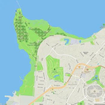
Point Molate Beach Park
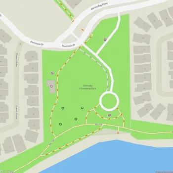
Interactive Park Map
About Point Molate Beach Park
A Glimpse into the Past
Once a bustling U.S. Navy fuel storage and transfer facility until 1995, Point Molate Beach Park has transformed into something entirely different. The City of Richmond took over the property in 2003, and after some much-needed cleanup and restoration work, reopened this coastal escape to the public in 2013.
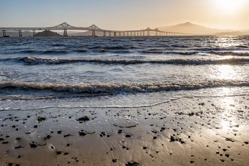
Where Bay Views Take Your Breath Away
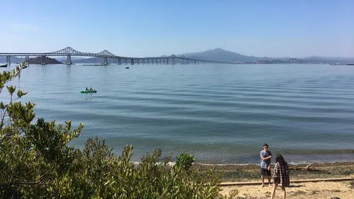
Spread across 413 acres of Richmond shoreline, Point Molate Beach Park sits just 1.5 miles north of the Richmond-San Rafael Bridge. With 1.4 miles of San Francisco Bay frontage, you'll be treated to sweeping panoramas that include Mount Tamalpais, Mount Saint Helena, and the graceful span of the Richmond-San Rafael Bridge.
Planning an event? Make a reservation at this park
This place flies under the radar for many Bay Area residents, making it something of a local secret. If you're looking to escape the typical beach crowds and enjoy some spectacular sunsets, this is your spot. The quiet here speaks volumes.
Sand Between Your Toes
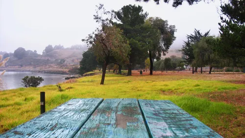
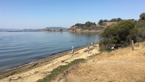
The beach itself offers a clean, expansive shoreline where gentle waves meet the sand. You can stroll along the water's edge or explore the grassy area that sits just above the beach.
Many people come specifically to hunt for sea glass and interesting rocks - little treasures the bay has polished and delivered to shore. Getting to the beach requires a short walk from the parking area along a path that's sometimes narrow and flanked by tall vegetation.
Been to this park? Share a or a
Dog owners, rejoice! Your four-legged friends are welcome here, making it an ideal place for a shoreline walk with your pup. Just keep in mind that the beach changes character with the tides - sometimes sandy and inviting, other times a bit muddier. Checking tide schedules before your visit isn't a bad idea.
Simple Comforts
The park keeps things refreshingly basic. You'll find several picnic benches with grills in the grassy area overlooking the beach, along with designated spots to safely dispose of hot coals. Parking is plentiful, so finding a spot for your vehicle shouldn't be an issue.
As for facilities, they're minimal - a portable toilet in the parking lot that's generally kept in good condition is about it. You should bring your own water since there are no drinking fountains available.
Ways to Spend Your Time
What you do here is really up to you. Beachcombing, picnicking, and simply soaking in the natural beauty are all on the menu. Unlike more developed urban parks, Point Molate offers a more authentic, untamed coastal experience.
If you're into fishing or flying kites, this can be a great spot when conditions are right. Kayakers will find the beach suitable for launching into San Pablo Bay during appropriate tide levels.
Wild at Heart
Just above the beach, you'll discover coastal prairie and northern coastal bluff scrub habitats - ecological communities that have become increasingly rare in the East Bay. These grasslands showcase an impressive variety of native perennial grasses and wildflowers.
Keep in mind that the park's industrial past means you might encounter uneven ground or remnants of old structures in some areas. The somewhat remote location contributes to the tranquil atmosphere that makes this place special - a quiet pocket of nature in the busy Bay Area.
Weekends tend to draw more visitors, while weekdays offer a more solitary experience. Both have their charms, depending on whether you're seeking social energy or peaceful reflection.
All Features & Facilities
Nature & Wildlife
Water Features & Activities
Visitor Services
Food & Gathering
Photo Gallery (click to enlarge)
Leave a Comment
ParkMagnet Score
Great Park