Richmond Greenway
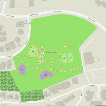
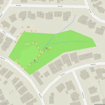
Interactive Park Map
About Richmond Greenway
Connecting Communities Through Green Space
Tucked within the urban landscape of Richmond, California, the Richmond Greenway stretches for 3 miles as a vibrant multi-use trail and linear park. This former railroad right-of-way is now a green corridor connecting the San Francisco Bay Trail on the western end at Garrard Boulevard to the Ohlone Greenway at its eastern terminus at San Pablo Avenue.
If you're looking to walk, jog, or cycle without dodging traffic, this urban pathway offers a peaceful route through the heart of Richmond's neighborhoods. Covering 32 acres, the greenway adds much-needed open space to an area that previously had limited recreational options.
What You'll Find Along the Way
The Richmond Greenway isn't just about getting from point A to point B (though it does make commuting more pleasant). You'll come across a practical connection between homes, public transit stops, local businesses, and civic centers.
Planning an event? Make a reservation at this park
As you travel the path, you'll encounter thoughtful environmental elements that bring nature into the city. Community gardens burst with local produce and flowers, areas of native plant landscaping support local ecosystems, and innovative stormwater management elements show green infrastructure in action.
People-Powered Improvements
What makes the greenway special is how deeply the community has embraced it. Local organizations regularly come together to breathe life into the space - hosting neighborhood events, tending the gardens, creating colorful public art installations, and spearheading improvement projects along the route.
A Work in Progress
Like many urban green spaces, the Richmond Greenway faces its share of challenges. Some sections encounter maintenance issues, and safety concerns exist in certain areas. But don't let that deter you - the city and dedicated community groups continue working to address these challenges, steadily enhancing the trail's amenities and making it more welcoming for everyone who visits.
All Features & Facilities
Nature & Wildlife
Visitor Services
Food & Gathering
Photo Gallery
Leave a Comment
ParkMagnet Score
Basic Park
Park Size
Opening Hours
Hours not availablePlan Your Visit
Weather
Top Restaurants Near Richmond Greenway
Red Onion
407 feet11900 San Pablo Ave, El Cerrito, CA 94530
Classic burger joint serving thick, fresh hamburgers and crispy fries in a nostalgic counter-seating atmosphere.
Gangnam Tofu Korean Cuisine
0.3 miles11740 San Pablo Ave Suite C, El Cerrito, CA 94530
Cozy Korean restaurant serving flavorful comfort food including spicy tofu soups, fried chicken, and traditional banchan.
Marty's Grill
0.4 miles1000 Nevin Ave, Richmond, CA 94801
A clean, family-owned grill serving fresh American fare including juicy burgers, Philly cheesesteaks, and crispy chicken tenders.