Fort Armistead Park
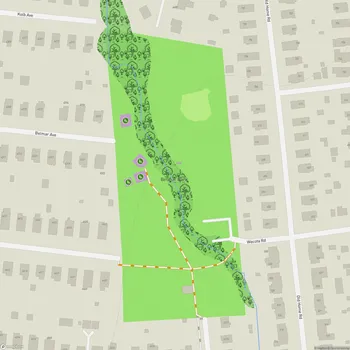
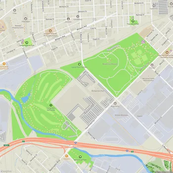
Interactive Park Map
About Fort Armistead Park
A Glimpse into the Past
Named after Major George Armistead, the commander of Fort McHenry during the War of 1812, Fort Armistead Park carries a piece of Baltimore's history in its very soil.
Built between 1897 and 1901, this fort wasn't just any military installation - it was part of the Endicott Program, an ambitious coastal defense system designed to shield Baltimore's busy harbor from potential threats. Complete with gun batteries and a mine casemate (which controlled naval minefields), it stood ready to protect the city, however it never actually saw combat. Instead, it found purpose as an emergency hospital during World War I and later as a place to store munitions during World War II.
What You'll Find Today
Spread across 22 acres at Baltimore's southeastern edge near Hawkins Point, this park offers something increasingly precious: public access to the Patapsco River shoreline.
Planning an event? Make a reservation at this park
The views here are worth the trip alone. From almost anywhere in the park, you can gaze out at the majestic Francis Scott Key Bridge spanning the waters of Baltimore harbor. The landscape itself is a pleasing mix - open grassy spaces giving way to shaded wooded areas, all punctuated by the abandoned fort structures that hint at stories from another era.
These weathered ruins have taken on a new life over the years. Now adorned with layers of graffiti and partially embraced by nature's slow reclamation, they've become a magnet for urban explorers and photographers seeking something different. Many consider these decorated remnants a kind of impromptu outdoor art gallery. Just remember to tread carefully if you explore them - these structures aren't maintained and safety isn't guaranteed.
Things to Do
Despite its somewhat forgotten status, the park offers several ways to connect with the outdoors. You can try your luck fishing from the pier, set up to catch crabs, wander the informal trails that wind through the property, or simply find a spot to sit and watch the water.
Been to this park? Share a or a
Boat owners, take note - there's a free boat ramp available if you want to get out on the Patapsco River. The park's position also makes it an excellent vantage point for watching massive ships navigate their way to and from the Port of Baltimore.
The fishing pier remains one of the better-maintained areas and draws a regular crowd of anglers throughout fishing season. If you're looking for that perfect waterfront photo, stop by during early morning or evening when the light plays across the harbor in spectacular ways.
Before You Visit
It's worth knowing that this is a no-frills destination - you won't find restrooms, playgrounds, or official picnic areas here. If you're planning more than a quick stop, bring your own chair or blanket for comfort.
The road leading to the park and the parking areas have seen better days, with potholes being a common hazard. Drive slowly and carefully on your approach.
You should also know that Fort Armistead has struggled with upkeep and security issues for some time. The natural beauty and historical significance remain, but you'll likely encounter litter during your visit despite the park's underlying charm.
All Features & Facilities
Nature & Wildlife
Water Features & Activities
Visitor Services
Food & Gathering
Photo Gallery
Leave a Comment
ParkMagnet Score
Decent Park