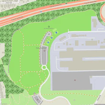
Canal Basin Park
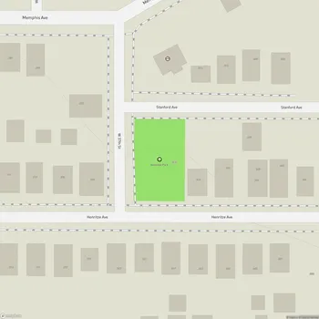
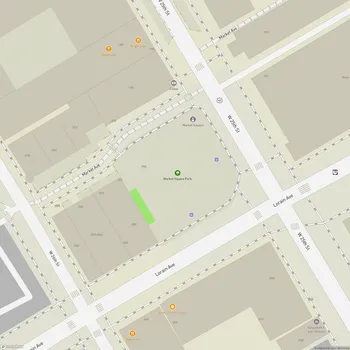
Interactive Park Map
About Canal Basin Park
A Glimpse into Cleveland's Past
Set in downtown Cleveland, Canal Basin Park spans 22 acres of greenspace on the East Bank of the Flats. This isn't just any urban park - it stands at the historic spot where the Ohio & Erie Canal met the Cuyahoga River back in 1832. Imagine boats arriving at this very location after journeying 110 miles from the Ohio River to Lake Erie, transforming Cleveland into a bustling hub of commerce and connection.
Today, the park acts as both a peaceful gathering spot and a window into the past, helping us appreciate the waterways that shaped Cleveland's industrial heritage.
Hit the Trail
Canal Basin Park marks the northern terminus of the Towpath Trail - a 101-mile path great for hiking and biking that stretches all the way to New Philadelphia, Ohio.
Planning an event? Make a reservation at this park
Recent upgrades have transformed over 30,000 square feet of asphalt into inviting green spaces and trails. If you're planning a visit, you'll discover comfortable seating areas, convenient bike racks, and a water fountain at the Towpath Trailhead to refresh yourself before or after your journey.
A Tribute to Heritage
Take a moment to visit the park's Irish Famine Monument, a poignant landmark erected in 2000. The stone monument, adorned with a Celtic cross, honors both those who perished during the Great Hunger and the brave souls who fled to Cleveland escaping the potato famine (1845-1850).
Two flagpoles stand alongside the monument, displaying the American and Irish flags - a testament to the rich Irish heritage woven into Cleveland's history.
Picture-Perfect Views
The park offers excellent views of downtown Cleveland and the winding Cuyahoga River. From here, you can spot the historic Center Street Swing Bridge, an engineering marvel from 1901 that recently reopened after renovations.
Been to this park? Share a or a
Look up to catch the interesting triptych mural on the Superior Detroit Bridge (Veterans Memorial Bridge) overhead - it's these little details that make the park experience more layered and interesting.
What's Coming Next
While Canal Basin Park is already worth visiting, exciting developments are on the horizon. Plans aim to transform the entire area into a more immersive space that celebrates both history and ecology.
Future enhancements include a curving boardwalk along the Cuyahoga River, a Cuyahoga River-themed playground for the little ones, and a recreated canal basin with a practical environmental purpose: catching, filtering, and slowly releasing stormwater.
Part of a Bigger Picture
The design incorporates elements that tell the story of the site's industrial and cultural heritage, while also highlighting environmental progress.
Canal Basin Park isn't standing alone in Cleveland's revitalization efforts. It's a key piece of the city's Shore-to-Core-to-Shore plan, an initiative focused on reconnecting Cleveland to its waterfronts, boosting economic development, and making the city's waterways more accessible to everyone.
All Features & Facilities
Nature & Wildlife
Water Features & Activities
Visitor Services
Food & Gathering
Photo Gallery
Leave a Comment
ParkMagnet Score
Decent Park
Park Size
Opening Hours
Plan Your Visit
Weather
Top Restaurants Near Canal Basin Park
Cleveland Chop
0.3 miles824 W St Clair Ave, Cleveland, OH 44113
Upscale steakhouse offering premium cuts, fresh seafood, and handcrafted cocktails in an energetic atmosphere.
Blue Point Grille
0.3 miles700 W St Clair Ave, Cleveland, OH 44113
Upscale seafood restaurant featuring fresh catches and oysters in an elegant multilevel dining room.
Merwin's Wharf
0.3 miles1785 Merwin Ave, Cleveland, OH 44113
Relaxed riverside establishment serving Southern-inspired comfort food including excellent shrimp and grits with outdoor seating.