Shepherd Canyon Park
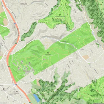
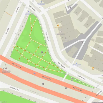
Interactive Park Map
About Shepherd Canyon Park
A Piece of Oakland History
Stretching across 34 acres of Oakland greenery, Shepherd Canyon Park came to life in 1975 as part of the Shepherd Canyon Corridor Plan - a community victory that stopped Highway 77 from cutting through this natural space. The park gets its name from the Shepherd Family, who settled on this land back in the late 1800s, leaving their mark on early Oakland history.
Nature's Canvas
This park is a delightful mix of landscapes - from open playing fields to winding hillside trails and a charming creek environment. The main fields actually sit on what used to be the middle section of Shepherd Creek's natural channel.
Planning an event? Make a reservation at this park
If you follow the water's journey, this creek eventually connects with Palo Seco Creek to form Sausal Creek as it flows down into Dimond Canyon. After a good rain, there's something magical about hearing the creek waters bubble to life while wildflowers perfume the air around the park.
Trails and Exploration
The hillside paths here are perfect if you're looking for a refreshing hike without leaving the city. Some trails reward your effort with gorgeous sunset views, and if you make it to the higher spots, you might even catch glimpses of the Bay sparkling in the distance.
For a longer adventure, try accessing the park via the Montclair Railroad Trail that winds up from Montclair Village. Many locals also enjoy simple strolls around the open field - ideal for those days when you just need some fresh air and green space.
Sports and Play
The park contains two football fields that are active with youth sports on weekends. Soccer goals are set up on the open field for impromptu games.
Been to this park? Share a or a
The wide, flat expanse makes this area incredibly versatile for all sorts of recreational activities throughout the year. Just a heads-up though - the field can get quite muddy during the rainy season, so plan accordingly!
A Dog's Paradise
Dogs seem to enjoy this park. While it's not an enclosed dog park, many visitors bring their dogs to run both on and off-leash across the open spaces. It's convenient when you want to exercise your dog without committing to a longer hike.
The open field and short trails into the hills provide good options for dog walking.
What You'll Find Here
Since 2008, the park has featured a dedicated parking lot, making visits much more convenient if you're driving. You'll also find restrooms, drinking water, and picnic tables scattered around the grounds - some nestled under magnificent oak trees that create dappled, cool shade on hot days.
Kids will enjoy the small climbing structure, and there's a quiet retreat on the back side of the park off Escher Drive: a secluded picnic area with creek access and a rope swing that brings out the adventurer in visitors of all ages.
The Heart of Community
Shepherd Canyon Park offers a tranquil atmosphere - a peaceful spot within Oakland's urban landscape. It's a green space where neighbors meet, families spend time together, and people can find quiet moments among the trees.
The park balances natural elements with accessibility - allowing for nature experiences close to home.
All Features & Facilities
Active Recreation
Nature & Wildlife
Water Features & Activities
Visitor Services
Food & Gathering
Photo Gallery
Leave a Comment
ParkMagnet Score
Good Park
Park Size
Opening Hours
Plan Your Visit
Weather
Top Restaurants Near Shepherd Canyon Park
Italian Colors
243 feet2220 Mountain Blvd #100, Oakland, CA 94611
Long-standing osteria serving classic Italian comfort food in a warm, family-friendly atmosphere with live music.
Oh G Burger
0.2 miles2062 Mountain Blvd, Oakland, CA 94611
A casual burger spot serving perfectly seasoned patties with caramelized onions and crispy sides.
Perle Bar
0.2 miles2058 Mountain Blvd, Oakland, CA 94611
Modern Mediterranean restaurant featuring an extensive wine selection, cheese, charcuterie, and fresh seafood offerings.