Martha McLean-Anza Narrows Park
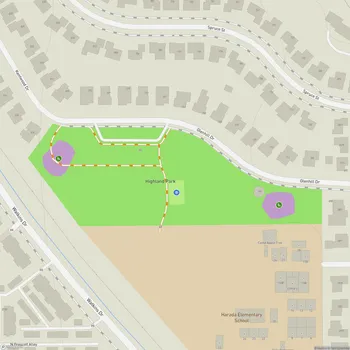
Interactive Park Map
About Martha McLean-Anza Narrows Park
Park Overview
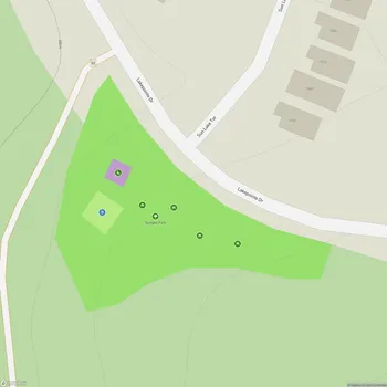
Located along the Santa Ana River in Riverside, California, Martha McLean-Anza Narrows Park covers 40 acres of natural beauty. Run by the City of Riverside Parks, Recreation and Community Services Department, this regional park has become something of a local treasure for both Riverside residents and visitors looking to escape the urban hustle.
What makes this spot special? The panoramic views of the surrounding landscape are definitely worth seeing. And if you're into trails, you'll love the easy access to the Santa Ana River Trail - perfect whether you're in the mood for a casual stroll, a more ambitious hike, or a bike ride through nature.
Historical Significance
Behind the park's name lies a story of environmental activism. It honors Martha McLean, a determined conservationist who, alongside Ruth Anderson, fought against the US Army Corps of Engineers' plans to channelize the Santa Ana River back in the 1960s. Their efforts helped preserve the natural state of this waterway we enjoy today.
Planning an event? Make a reservation at this park
The "Anza Narrows" portion of the name? That's a nod to history. This spot marks where the Juan Bautista de Anza Expedition crossed the river in 1774 and 1776. If you explore the park, you'll come across a marker commemorating this crossing - a small piece of the much larger Juan Bautista de Anza National Historic Trail that winds through Southern California.
Landscape and Views
From its position on a shady bluff, the park provides excellent views of the Santa Ana River below and the San Gabriel Mountains in the distance. The grounds themselves are a pleasant mix of shaded picnic spots and open grassy areas that extend to the edge of the bluffs overlooking the river.
This diverse landscape creates a wonderful setting for outdoor activities and quiet nature appreciation. Keep an eye out for the numerous ground squirrels that call this park home - they've become permanent residents and add a touch of wildlife to your visit.
Recreational Activities
If you're into disc golf, you're in luck. The park's 18-hole disc golf course is popular with locals. It uses the hillside's natural contours to create challenging pin positions suitable for players of various skill levels.
Been to this park? Share a or a
You'll also find volleyball courts with sand surfaces across the park, but be aware that some areas might need a bit of TLC.
The wide, winding paths that circle through the grounds are ideal for a morning jog, an afternoon walk with your dog, or as a starting point to connect with the broader Santa Ana River Trail for those looking to extend their adventure.
Amenities
Planning a get-together? The park offers numerous picnic areas throughout, many equipped with BBQ grills meant for cookouts. For larger gatherings, several covered gazebos provide welcome shade and make ideal spots for family celebrations or group events.
You'll come across plenty of benches scattered around for when you need a moment to sit and take in the scenery. And for those visiting with four-legged friends, multiple dog waste stations help keep the grounds clean and enjoyable for everyone.
Conservation Efforts
Beyond recreation, this park plays an important role in local environmental stewardship. Inland Empire Waterkeeper, a nonprofit focused on protecting local water quality, has partnered with the City of Riverside to adopt the park.
Through regular volunteer cleanup efforts, they work to remove trash from the riverbed and surrounding areas, helping to preserve and protect the Santa Ana River ecosystem for future generations to enjoy.
All Features & Facilities
Active Recreation
Nature & Wildlife
Water Features & Activities
Visitor Services
Food & Gathering
Photo Gallery
Leave a Comment
ParkMagnet Score
Great Park