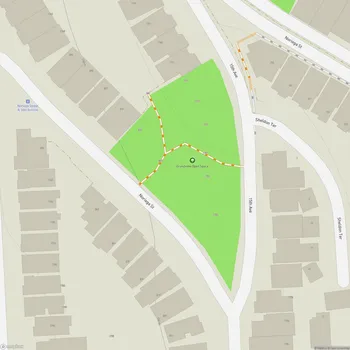
Bayview Hill Park
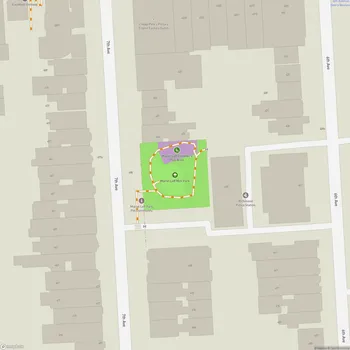
Interactive Park Map
About Bayview Hill Park
Natural Features
Nestled in the Bayview-Hunters Point neighborhood of southeast San Francisco, Bayview Hill Park spans 46.63 acres of natural beauty. The park is dominated by a prominent hill - known locally as either Bayview Hill or Candlestick Hill - that rises to an impressive 425 feet above sea level.
This natural landmark stands out whether you're coming from the former Candlestick Park site to the east or driving along the Bayshore Freeway to the west. Thanks to its elevation, the hill rewards climbers with stunning panoramic views of San Francisco and the bay - making it a wonderful perch for watching special events like New Year's Eve fireworks.
Flora and Fauna
This park is truly a biodiversity hotspot, housing one of the richest collections of plants and animals in San Francisco's natural areas. If you visit during mid-spring, you're in for a treat - the grasslands burst into some of the city's most spectacular wildflower displays.
Planning an event? Make a reservation at this park
Beyond the grasslands, you'll come across coastal scrub, eucalyptus and oak groves, and San Francisco's largest population of Islais cherry trees. Walking the paths here feels like stepping into a hidden woodland retreat, despite being right in the middle of the city.
Wildlife watching here is surprisingly rewarding. On sunny days, keep your eyes peeled for western fence lizards and California alligator lizards basking on rocks. You might even spot non-poisonous snakes like common garter snakes, Pacific gopher snakes, or Pacific ring-neck snakes slithering through the underbrush.
Look up and you'll often see red-tailed hawks circling overhead, while great horned owls might be napping in tree notches during daylight hours. The distinctive tapping of woodpeckers frequently echoes around the park.
Trails and Recreation
The main trail here is a paved road that creates a loop through the park, beginning and ending at Key Avenue's eastern end. It's well-maintained and perfect whether you're walking, jogging, or squeezing in a quick workout.
Been to this park? Share a or a
Be prepared for a bit of a challenge at first - the initial section climbs quite steeply. But don't worry, your effort is rewarded when the path levels into a flat circular route around the hill, making the rest of your journey much more leisurely.
The park offers a peaceful atmosphere. It's a good spot to decompress and exercise surrounded by nature, away from the city's constant buzz.
Historic Features
As you walk the roadway, you'll notice some interesting historical remnants - look for the old stairs and retaining walls constructed by the Works Progress Administration during the Great Depression.
History
The park has survived quite a journey through time. Around 1900, it nearly fell victim to development when George Hearst and the Bay View Land Company planned to transform it into an exclusive neighborhood for the wealthy.
Luckily, these plans fizzled out as developers deemed the location too remote from downtown. In 1902, the city purchased a large portion of the hill's crest, initially planning to build an isolation hospital.
Those plans changed too, thanks to concerns raised by nearby landowner Charles Crocker, and the hilltop was officially designated as a park instead. The park expanded in 1997 when San Francisco acquired an additional 16 acres of the upper northeast slope to preserve as open space.
Amenities and Access
The park welcomes visitors daily from 5AM to 12AM, giving you plenty of time to explore. Note that there are no public restrooms within the park boundaries.
Bayview Hill Park feels removed from civilization while being situated in the Bay Area. This blend of natural space and urban accessibility makes it a worthwhile place to visit in San Francisco.
All Features & Facilities
Nature & Wildlife
Visitor Services
Food & Gathering
Photo Gallery
Leave a Comment
ParkMagnet Score
Decent Park