Sand Run Metropark - Big Bend Area
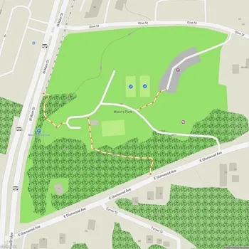
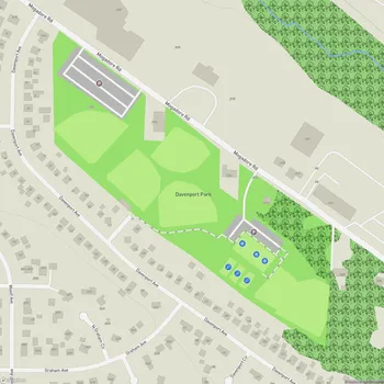
Interactive Park Map
About Sand Run Metropark - Big Bend Area
Natural Features
Spreading across 998 acres, Sand Run Metropark offers a rich tapestry of natural landscapes - from lush forests to flowing streams and tranquil wetlands. The park's namesake, Sand Run stream, meanders through the grounds and is crossed by a ford on Sand Run Parkway - a spot that's become something of a local landmark.
Take a moment to appreciate the park's diverse ecosystem as you explore. The cool, shady ravines harbor majestic hemlocks, delicate ferns, distinctive skunk cabbage, and impressive colonies of horsetails. It's a peaceful spot to spend time in nature away from city life.
Recreational Opportunities
With over 15 miles of trails crisscrossing the park, you'll come across plenty of options for hiking, jogging, or even cross-country skiing when the weather permits. The Parkway Jogging Trail is popular with runners and walkers throughout the year.
Planning an event? Make a reservation at this park
Feel like venturing further? You can easily connect to the Towpath Trail or explore paths in neighboring Cascade Valley. The network offers many options for both casual walks and longer hikes. The wooden bridges provide nice views of the valley below.
Seasonal Activities
Sand Run Metropark can be enjoyed in all seasons. Winter transforms the small lake into a natural ice skating rink, while the park's sledding hill becomes the go-to spot after a good snowfall.
Each season paints the park in a different light - spring brings wildflowers, summer offers shaded refuge, fall delivers a spectacular color show, and winter wraps the landscape in serene stillness. The trails are available for hiking and recreation throughout the year.
Amenities
Sports enthusiasts will appreciate the soccer fields and open areas fantastic for casual games or workouts. Restroom facilities are conveniently located across the park, including near the camping areas.
Been to this park? Share a or a
If you're looking to extend your stay, primitive camping is available in designated spots. Just note that fires aren't permitted, so plan accordingly. The peaceful overnight experience is wonderful, however you might hear the distant howls of coyotes - just part of sharing space with the local wildlife.
Historical Significance
Established in 1929, Sand Run Metropark stands as one of the oldest havens in the Summit Metro Parks system. Long before it became a park, this land served as a campsite for Indigenous peoples.
The Portage Path running through the park was once an important Indigenous trail connecting the Cuyahoga and Tuscarawas rivers. Later, it marked the western boundary of the United States.
The Civilian Conservation Corps constructed Sand Run Parkway in the 1930s, along with many shelters and structures that remain standing today.
As you walk along the tow path, you might spot trains passing by - a gentle reminder of how transportation through this valley has evolved while the natural beauty remains timeless.
All Features & Facilities
Active Recreation
Nature & Wildlife
Water Features & Activities
Visitor Services
Food & Gathering
Photo Gallery
Leave a Comment
ParkMagnet Score
Top Park
Park Size
Opening Hours
Plan Your Visit
Weather
Top Restaurants Near Sand Run Metropark - Big Bend Area
Sushi Asia Gourmet
0.4 miles1375 N Portage Path, Akron, OH 44313
Pan-Asian restaurant serving creative fusion dishes alongside traditional Chinese and Japanese cuisine including fresh sushi.
Vine Valley Foods
0.5 miles1450 N Portage Path, Akron, OH 44313
Mediterranean restaurant offering a good selection of dishes in a grocery store setting.
Papa Joe's
0.6 miles1561 Akron Peninsula Rd, Akron, OH 44313
Family-run establishment serving traditional Southern Italian dishes alongside steaks and seafood in a comfortable casual atmosphere.