Garland Central Park
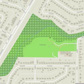
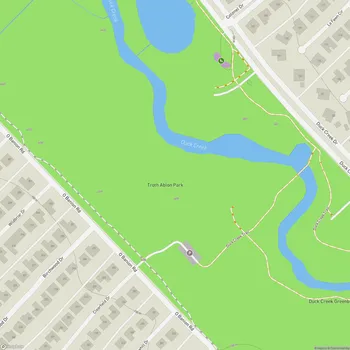
Interactive Park Map
About Garland Central Park
A Century of Community Gathering
Nestled along the flowing waters of Duck Creek, Garland Central Park spans a generous 60.7 acres and has been bringing locals together for over a hundred years. This green space has roots going back to 1854, when it was part of the G.W. "Wash" Routh homestead.
By 1880, the park was already a social hotspot, hosting massive community picnics that drew thousands. Throughout its history, locals have known it by several names - from the simple "old Garland Park grounds" to "Williams Park" and "City Park" - before it officially became Garland's first municipal park in 1948.
Nature's Quiet Corner
About 10 acres along the northern edge remain undeveloped, preserving Duck Creek's natural corridor. The park offers a mix of wooded areas and open recreational spaces.
Planning an event? Make a reservation at this park
Back in the 1920s, a dam across Duck Creek created a natural swimming hole affectionately called "Lake Garland." While that dam is long gone, the creek itself continues to be a peaceful feature where you can stroll, reflect, or simply watch the water flow by. The creek provides a natural break from the surrounding city environment.
Modern Fun for Everyone
Central Park has a variety of amenities. The recently renovated playground is fully fenced and includes accessible equipment for children of all abilities. Kids particularly love the merry-go-round, the exciting rolling slide, and various climbing structures that challenge their imagination.
Sports enthusiasts won't be disappointed with the selection of tennis courts, basketball courts, baseball fields, and sand volleyball courts. The spacious open fields are well-suited for a casual game of football or just throwing a frisbee around.
Been to this park? Share a or a
When it's time to refuel, multiple picnic areas provide plenty of room for family gatherings, with space for grills and outdoor meals. Clean restrooms are available in a small on-site building - always a practical plus for families spending the day outdoors.
The Granger Recreation Center
Need a break from the Texas sun? The park's Granger Recreation Center offers freshly renovated indoor spaces for community activities and events. It's a wonderful complement to the outdoor areas, making Central Park a year-round destination regardless of weather.
Little Extras That Make a Difference
Bring your four-legged friends along - the park is dog-friendly with dedicated spaces where pets can play and exercise. The layout is great for dog walking, with plenty of interesting paths to explore together.
Here's an unexpected treat: look across from the park and you might spot the deer farm located nearby, offering a surprising wildlife viewing opportunity right in downtown Garland.
A Place in History
The park's deep roots in local history have earned it recognition with a Garland Landmark Society historical marker. History buffs might also appreciate that the park sits along the route of the historic Bankhead Highway - one of America's early transcontinental routes - commemorated by a Texas Historical Commission marker installed in 2011.
All Features & Facilities
Active Recreation
Nature & Wildlife
Water Features & Activities
Visitor Services
Food & Gathering
Photo Gallery
Leave a Comment
ParkMagnet Score
Great Park