Eben G. Fine Park
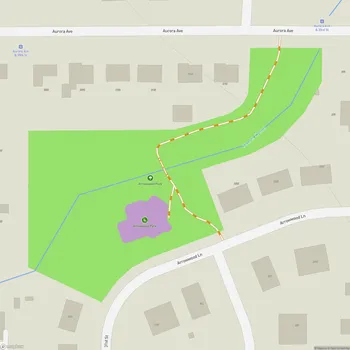
Interactive Park Map
About Eben G. Fine Park
Historic Origins
Take a step back in time to 1921 when Eben G. Fine Park first opened its gates as a free public auto camp. This little glimpse of Boulder history came together as a community effort, with local groups including the Auto Trades Association, Commercial Association, Lions Club, and Rotary Club contributing to the city.
Back then, the stone shelter house and restroom provided spaces where tourists could cook meals while taking a break from their travels. In those early days, the auto camp became quite the hotspot, drawing thousands of visitors from across America and beyond.
Location and Features
Covering 4.3 acres at the base of the Flatiron Mountains, Eben G. Fine Park sits along the south banks of Boulder Creek. Nestled right at the mouth of Boulder Canyon, it's perfectly positioned for anyone looking to picnic, unwind, or simply soak in some nature.
Planning an event? Make a reservation at this park
The park includes sections of Boulder Creek and the Boulder Creek Path, connecting to nearby hiking trails and bike paths. If you're itching to explore more of Boulder's natural beauty, you'll appreciate how the park connects to nearby hiking trails and bike paths.
You can find a lovely mix of sun-drenched open spaces and cool shady spots, with soft grass that's well-suited for lounging or playing. Several walking paths meander alongside the river, where you can discover quiet nooks and charming little waterfalls as the creek gently tumbles through the landscape.

Recreational Activities
If you've ever seen people floating down Boulder Creek in inner tubes during summer, chances are they launched their aquatic adventure from this park. It's the go-to starting point for tubing enthusiasts, with May and June offering particularly thrilling conditions when the water runs high.
Been to this park? Share a or a
The creek's refreshing waters are fantastic for a cooling dip, with several calm pools that offer a more relaxed swimming experience. On those scorching summer days, there's nothing quite like submerging yourself in the creek's natural air conditioning.
The park strikes that perfect balance between nature and convenience, creating an ideal setting for picnics, reading, meditation, or just being. Despite its popularity, the soothing sound of rushing water and beautiful surroundings maintain a sense of tranquility.

Facilities
Eben G. Fine Park offers several amenities. There's a spacious covered pavilion with picnic tables, plus additional tables scattered throughout - some right by the creek for that perfect water-side lunch. The stone restroom building combines historical character with practicality - it's heated, clean, and spacious.
Kids will make a beeline for the playground with its swings and climbing equipment, plus a sandbox area for creative play. Parents can breathe a little easier knowing the playground sits on cushioning wood chips and has fencing, although you'll still want to keep an eye on little ones given the fast-flowing creek nearby.
The park connects seamlessly to Boulder's impressive trail network, giving you options for everything from casual walks to more challenging hikes or bike rides. And yes, there's a water fountain to refill your bottle before hitting the trails.
Practical Information
Dog owners, your four-legged friends are welcome here, although it's best to keep them leashed in busier areas. The parking situation is something to plan for - the small lot holds fewer than 20 vehicles, but you can find street parking within walking distance. Just be prepared for crowds on weekends and holidays, especially during summer when the park really comes alive.
A word of caution: the creek's current can pack quite a punch, particularly during high water seasons. If tubing or kayaking is on your agenda, consider gearing up with appropriate safety equipment like helmets and life vests.
Park Namesake
In the 1960s, the park was officially named after Eben G. Fine, a Boulder pharmacist who promoted the city with such enthusiasm that he earned the nickname "Mr. Boulder." Today, the park named after him remains a popular recreational spot in Boulder.
All Features & Facilities
Nature & Wildlife
Water Features & Activities
Visitor Services
Food & Gathering
Photo Gallery (click to enlarge)
Leave a Comment
ParkMagnet Score
Good Park
Park Size
Opening Hours
Plan Your Visit
Weather
Top Restaurants Near Eben G. Fine Park
Flagstaff House
0.4 miles1138 Flagstaff Rd, Boulder, CO 80302
Refined American fine dining restaurant offering spectacular mountain views and elevated cuisine atop Flagstaff Mountain.
Nick-N-Willy's Pizza
0.5 miles801 Pearl St, Boulder, CO 80302
Counter-serve pizza chain specializing in gourmet pies with generous toppings and quick preparation times.
Sherpa’s Adventure Restaurant and Bar
0.5 miles825 Walnut St, Boulder, CO 80302
Authentic Nepalese restaurant serving flavorful dumplings, noodles, and curry dishes in a charming mountain-themed setting.
My Neighbor Felix Boulder
0.6 miles901 Pearl St, Boulder, CO 80302
Polished Mexican restaurant featuring modern cuisine, craft margaritas, and a chic atmosphere with patio dining.
Top Hotels Near Eben G. Fine Park
Foot of the Mountain Motel
112 feet200 Arapahoe Ave, Boulder, CO 80302
A charming retro motel featuring cozy cabins and rooms near Boulder Creek with complimentary breakfast.
St Julien Hotel & Spa
0.6 miles900 Walnut St, Boulder, CO 80302
Upscale modern hotel featuring elegant rooms with soaking tubs, fine dining, pool, and full-service spa.