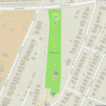
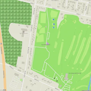
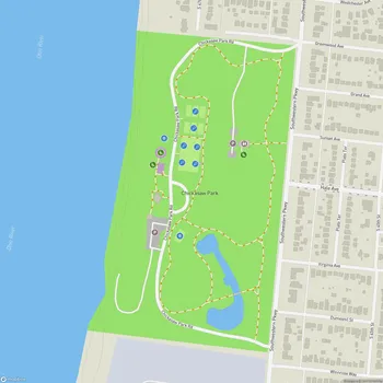
Shawnee Park
Interactive Park Map
About Shawnee Park
A Green Location Along the Ohio
Right next to the western edge of Louisville, Shawnee Park covers 284 acres of riverside land with a rich history. Designed in 1891 by Frederick Law Olmsted (yes, the same visionary behind New York's Central Park), this historic space is one of three crown jewels in Louisville's Olmsted park system.
The park unfolds across natural tiers that gently slope toward the Ohio River, creating a landscape that feels both designed and effortlessly natural. Mature trees cast cooling shadows across the grounds - excellent for those sticky Kentucky summer days when shade becomes your best friend.
The Heart of Shawnee
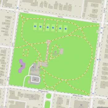
If you're looking for wide open spaces, the 35-acre Great Lawn won't disappoint. This sprawling meadow sits encircled by a winding drive and thoughtful border plantings, offering plenty of room to toss a frisbee, set up a picnic, or simply lie back and cloud-watch.
Planning an event? Make a reservation at this park
One of the park's most charming aspects is how it celebrates its riverside setting. As you drive through, you'll encounter five specially designed viewpoints that perfectly frame the Ohio River - little moments of "wow" built right into your visit. There's also a boat ramp for when you're feeling the call of the water, whether for fishing or taking out a small craft.
History buffs will appreciate the 1915 rest shelter, which has earned its place on the National Register of Historic Places. Across the grounds, several picnic shelters with tables offer perfect spots for family gatherings or a simple lunch in the shade.
Play Your Way
Shawnee doesn't skimp on sporting options. Baseball fields, basketball courts, and tennis courts dot the landscape, catering to athletes of all stripes. The basketball courts deserve special mention as home to the legendary Dirt Bowl summer league.
Been to this park? Share a or a
This Louisville tradition brings the courts alive with competitive games, cheerful spectators, food vendors, and the kind of community atmosphere that makes you glad you came.
For the little ones, there's both a standard playground with the usual suspects (swings, slides) and a more adventurous natural playground featuring wooden obstacle courses and elements that bring kids closer to nature. When temperatures climb, the spray park becomes a magnet for families looking to cool down without a full swim day commitment.
The park's well-maintained walking trail offers a great circuit for your morning jog or evening stroll. And since 2018, mountain biking enthusiasts have enjoyed the 400-foot-long bicycle pump track, part of a thoughtful initiative to introduce local youth to the sport.
Natural Retreats
One of the park's more recent and serene additions is the restored Lily Pond. With its floating islands of vegetation, resident ducks and turtles, it's become a peaceful spot for reflection. On special evenings, subtle lighting transforms the pond into something truly magical as colors dance across the water's surface.
Nearby chess tables invite strategic minds to settle in for a game or two - perhaps one of the most contemplative ways to enjoy the park's natural beauty.
A Park With History
Like many public spaces in America, Shawnee's story includes difficult chapters. From 1924 until 1954, the park was segregated for whites only - a reflection of the painful racial policies of the time. Post-desegregation, the park has continued to evolve, with improvements and additions that better serve the whole community.
Community Heartbeat
Today's Shawnee Park pulses with community life. You can find everything from spirited sports tournaments and concerts to holiday celebrations and multi-generational family reunions taking place under its canopy of trees.
During winter holidays, light displays have transformed sections of the park into twinkling wonderlands that brighten the longest nights of the year.
With its historical significance and regular community events, Shawnee Park has become an important part of Louisville's outdoor landscape. The park is most active during daylight hours, but it's a pleasant place to visit any time of day.
All Features & Facilities
Active Recreation
Nature & Wildlife
Water Features & Activities
Visitor Services
Food & Gathering
Photo Gallery
Leave a Comment
ParkMagnet Score
Top Park
Park Size
Opening Hours
Plan Your Visit
Weather
Top Restaurants Near Shawnee Park
Agave & Rye New Albany
0.5 miles324 E Main St, New Albany, IN 47150
Creative taco restaurant featuring specialty tacos, craft margaritas, and a popular rooftop bar with vibrant atmosphere.
The Exchange Pub + Kitchen
0.5 miles118 W Main St, New Albany, IN 47150
Rustic-chic gastropub serving New American dishes crafted with locally-sourced ingredients in an upscale atmosphere.
PARLOUR
0.5 miles225 State St, New Albany, IN 47150
A pizza restaurant serving tasty pies and chicken wings in a nicely decorated setting with good service.