Nut Island
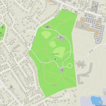
Interactive Park Map
About Nut Island
A Peninsula in Name Only
Despite its name, Nut Island is technically a peninsula: a former island now joined to Quincy's Houghs Neck neighborhood by a short causeway. It covers about 20 acres and is part of the Boston Harbor Islands National Recreation Area - and unlike most of the harbor islands, you can get here by car or bike.
From Grazing Land to Sewage Plant
The site has a long, layered past. Indigenous peoples likely visited seasonally before European colonization, and colonial settlers later grazed cattle here.
Planning an event? Make a reservation at this park
Later, Nut Island became a key part of the region's wastewater system. A primary treatment plant operated here from 1952 until it was demolished after a newer facility came online. Management problems at that plant in the 1980s even gave their name to the "Nut Island effect", a pattern of organizational dysfunction that has since been studied in management literature.
The Nut Island Headworks still operates on the site, screening grit and large objects from sewage before it's pumped through a 4.8-mile deep-bore tunnel to the treatment plant on Deer Island. Run by the Massachusetts Water Resources Authority (MWRA), the system serves 21 South Shore communities.
Paths, a Pier and Harbor Views
For all that infrastructure, the site has been turned into a pleasant landscaped park. Paved footpaths and a 2,500-foot loop road wind around it, with historical markers filling in the backstory as you go. The island rises to only about 10 feet and is ringed by a rip-rap retaining wall.
Along the way you'll pass a pier, an entry gate, an Alger Foundry monument, MWRA tunnel ventilation ducts, benches and stone walls, and there's a small beach area too. Trees and shrubs have been planted throughout, softening what was once a largely industrial site.
Fishing from the pier is popular, and the grassy areas are good for spreading out a picnic blanket. The views are the real highlight: on a clear day you can see the Boston skyline and nearby islands including Peddocks, Hangman, Rainsford, Moon and Long Island - and it's a particularly good spot for watching the sunset.

Before You Go
The park is open 24 hours a day. Parking is free but limited and can fill up in summer, and the narrow streets of Houghs Neck are lined with parked cars, so take it slow on the way in. Portable restrooms are on site, dogs are welcome, and ticks have been reported, so take the usual precautions.
All Features & Facilities
Nature & Wildlife
Water Features & Activities
Visitor Services
Food & Gathering

Upcoming Events
Loading local events...
Photo Gallery
Notable Sights (3)
Points of interest, landmarks, and things to see in this park
Monument (1)
A historical monument on the park grounds that connects the site to its layered industrial and civic past.
Building (1)
An active sewage screening facility that is part of a remarkable engineering system, pumping treated water through a 4.8-mile deep-bore tunnel to Deer Island and serving 21 South Shore communities.
Structure (1)
A fishing pier extending into Boston Harbor that serves as one of the park's most popular spots, offering excellent views of nearby islands and the Boston skyline.