Deming Heights Park
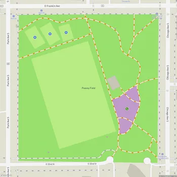
Interactive Park Map
About Deming Heights Park
A Hilltop Haven
Perched at 963 feet above sea level, Deming Heights Park claims the title of highest point in the Minneapolis park system. This 10.65-acre neighborhood retreat offers some seriously breathtaking views of the Minneapolis skyline - especially magical if you catch it during sunset.
There's a spot called Norwegian Hill where locals gather for mini meet-ups and quiet moments of city-gazing. It's one of those places that many Twin Cities residents consider a hidden treasure - the kind you almost want to keep secret, but it's too good not to share.
A Park With Stories
Back in 1913, this elevated patch of land was scooped up as part of the St. Anthony Boulevard project. People initially called it Grandview Park (for obvious reasons). By 1930, it was officially renamed to honor Portius C. Deming, a dedicated park commissioner who served from 1895-1899 and again from 1909-1919.
Planning an event? Make a reservation at this park
You'll discover this natural perch at the intersection of St. Anthony Parkway and Fillmore Street NE, where it plays its part in the larger Grand Rounds Scenic Byway system - Minneapolis' incredible interconnected parkway.
Nature's Playground
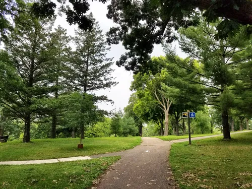
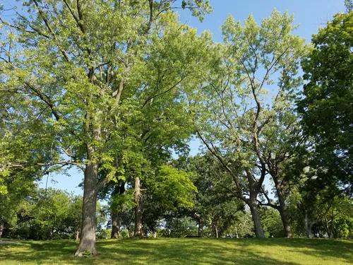
The landscape here rolls and dips with hills blanketed by mature trees, creating what feels like a peaceful forest escape right in the middle of urban life. Winding paths invite you to wander through the park, taking in both the natural beauty and those city views that never get old.
Keep your eyes peeled for the resident flock of wild turkeys that call this place home - they're often spotted strutting around like they own the place (which, fair enough, they kind of do). And for a touch of whimsy, see if you can spot the charming elf door carved into one of the trees. It's these little surprises that make Deming Heights special.
Ways to Enjoy
While Deming Heights focuses primarily on preserving its natural charm rather than cramming in recreational facilities, there's still plenty to do here. Bike trails snake through the terrain, offering some thrilling downhill stretches for those who enjoy a bit of adventure on wheels.
Been to this park? Share a or a
The park shines as a peaceful retreat where families can let kids explore safely while adults take a moment to breathe and soak in those panoramic views. Grassy clearings make perfect spots for impromptu picnics or simply lounging with a good book.
An Ecological Anchor
Beyond its pretty face, this park serves a crucial environmental purpose. It provides valuable understory habitat for urban wildlife, creating a refuge for various bird species and occasionally hosting small mammals like foxes passing through.
As a key piece of the St. Anthony Parkway system, Deming Heights functions as an important ecological stepping stone, helping connect green spaces all the way to the mighty Mississippi River.
All Features & Facilities
Nature & Wildlife
Food & Gathering
Photo Gallery (click to enlarge)
Leave a Comment
ParkMagnet Score
Decent Park
Park Size
Opening Hours
Plan Your Visit
Weather
Top Restaurants Near Deming Heights Park
Chimborazo
0.3 miles2851 Central Ave NE, Minneapolis, MN 55418
Authentic Ecuadorian restaurant featuring traditional Andean dishes, flavorful specialties, and warm hospitality in a cozy setting.
Hazel's Northeast
0.3 miles2859 Johnson St NE, Minneapolis, MN 55418
Cozy neighborhood spot serving elevated American comfort food with creative dishes and friendly service.
Parkway Pizza
0.4 miles2851 Johnson St NE, Minneapolis, MN 55418
A popular pizza restaurant serving quality thin and thick crust pizzas with friendly service and atmosphere.
Holy Land
0.7 miles2513 Central Ave NE, Minneapolis, MN 55418
Middle Eastern restaurant and deli serving traditional from-scratch dishes with an attached market for groceries.