Orvin "Ole"Olson Park
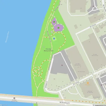
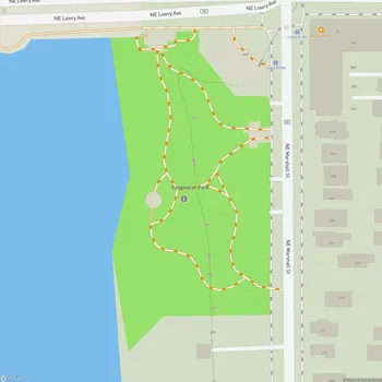
Orvin "Ole"Olson Park Map
About Orvin "Ole"Olson Park in Minneapolis
Orvin "Ole" Olson Park is a small, serene park located along the Mississippi River in Minneapolis, MN. Spanning 3.47 acres, this park is part of the Above the Falls Regional Park system and offers a peaceful retreat amid the city's urban environment. It is well-known for its picturesque views of the downtown Minneapolis skyline and the riverfront, attracting walkers, cyclists, and nature enthusiasts of all ages.
The park features paved biking and walking paths that connect with larger pathways, such as the James I. Rice Parkway and West River Parkway. These trails make it a popular spot for recreational activities and provide easy access to other areas along the Mississippi. The park's wide open space, surrounded by trees, creates a tranquil ambiance that allows visitors to unwind and enjoy the natural surroundings.
Efforts to restore and maintain the park's ecological health have been ongoing since 2015. Projects include vegetation restoration, soil remediation, and prairie habitat establishment to ensure long-term environmental sustainability. Upcoming plans involve more improvements, including better trail connections and a riverfront gathering space, enhancing the park's accessibility and usability for community members.
Historically, Ole Olson Park was once known as Skyline Park until its renaming in 2006 to honor former park commissioner Orvin "Ole" Olson, who significantly contributed to riverfront park policies and planning in Minneapolis. The land was acquired in 2002 and transformed into the park visitors enjoy today, opening its first trails in 2007. The site also includes remnants of its industrial past, with ongoing efforts to address contaminated soils along the riverbank.