Pig's Eye Regional Park
Interactive Park Map
About Pig's Eye Regional Park
Natural Features
Stretching along the Mississippi River in Saint Paul, Minnesota lies Pig's Eye Regional Park - a sprawling 1,200-acre natural haven that, despite being the largest park in the city, remains something of a local secret.
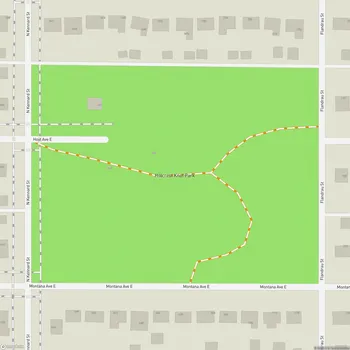
The park contains a 500-acre lake and has informal hiking paths for those who want to explore. Bird enthusiasts will find plenty to observe here. Home to one of the largest urban heron and egret rookeries in the Midwest, it's the kind of spot where binoculars become your best friend. Eagles are regular residents here too - you'll likely spot bald eagles soaring alongside great blue herons if you spend any time watching the skies.
Planning an event? Make a reservation at this park
The park's rich ecosystem supports diverse wildlife and represents a crucial rest stop for birds migrating along the Mississippi Flyway, making each visit a potentially different experience depending on the season.
History and Context
The story of Pig's Eye is as layered as the land itself. What once was Native American territory later became a dump site, then evolved into a Superfund site, before finally transforming into the undeveloped park we see today.
Situated within the East Side River District, Pig's Eye exists at an intersection of ecology, history, culture, and industry. The park doesn't exist in isolation - it's surrounded by private industries, railroads, and other facilities that can make getting there a bit of an adventure in itself.
Been to this park? Share a or a
Though rich with significant local history, you won't find historical displays or interpretive signs here yet - the stories of this land remain mostly in the landscape itself rather than on plaques or markers.
Access Information
Getting to Pig's Eye Regional Park requires a bit of determination. You have two main options: the north entrance off Fish Hatchery Road or the west entry point via Pig's Eye Lake Road.
Be prepared for some rough travel - the access roads aren't exactly well-maintained and can become problematic when it rains. Some visitors have even encountered mudslides during particularly wet periods. Once you arrive, you'll discover the actual park trails after crossing the bridge over the creek at the entrance.
This relative isolation means you can experience a sense of wilderness that's uncommon within the city.
Visitor Expectations
If you're planning a visit, it's important to understand what Pig's Eye is - and isn't. This is largely undeveloped parkland without the amenities you might expect elsewhere. You won't find officially maintained trails, restrooms, or visitor centers here.
There is an archery field near the park headquarters, standing as one of the few developed features in an otherwise natural landscape.
What Pig's Eye offers instead is something increasingly rare: a genuine, unmanicured natural experience within city limits. The park's rugged character appeals to those seeking solitude and a more authentic connection with nature. And yes, thanks to its under-the-radar status, you'll likely have vast stretches of this wild urban oasis all to yourself - a true luxury in a metropolitan area.
All Features & Facilities
Nature & Wildlife
Water Features & Activities
Photo Gallery
Leave a Comment
ParkMagnet Score
Decent Park
Park Size
Opening Hours
Plan Your Visit
Weather
Top Restaurants Near Pig's Eye Regional Park
Las islas
673 feet600 Concord St N, South St Paul, MN 55075
A Mexican and seafood restaurant offering delicious tacos, burritos, and specialty fish dishes at moderate prices.