Lower Landing Park
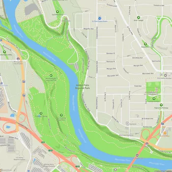
Interactive Park Map
About Lower Landing Park
Riverside Retreat
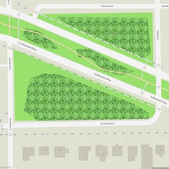
Nestled southeast of Lowertown in Saint Paul, Minnesota, Lower Landing Park spans 21.4 acres along the Mississippi River floodplain. This green space, part of the Great River Passage, provides a retreat from the urban environment while still being just a stone's throw from downtown.
The Samuel H. Morgan Regional Trail meanders through the park, hugging the river's edge. As you walk, you'll notice this is actually a busy barge area - a reminder of the working river that has shaped the city. The park sits at a point where the mighty Mississippi makes its second major bend, creating some truly picturesque views.
A Touch of History
The park neighbors Lambert's Landing, a historic dock with a story to tell. Once a bustling port welcoming hundreds of ships daily in its heyday, it still serves tows and passenger steamboats today. It offers a glimpse into Minnesota's river commerce history.
Planning an event? Make a reservation at this park
From various points in the park, you can take in impressive views of the river traffic and the surrounding industrial landscape. You might find it interesting to watch barges navigate the waters that have been a transportation route for centuries. And don't miss walking beneath the nearby highway bridge - its massive scale creates an interesting architectural contrast against the natural setting.
Finding Your Way
The Sam Morgan Regional Trail provides convenient access for those on foot or bicycle at both ends of the park. If you're planning to explore the entire space, know that it's about 0.6 miles from the west parking lot to the eastern maintenance entrance.
If you're arriving by car, your best bet is the west parking lot. The east end has a gate that's generally only open for maintenance vehicles. Once inside, the park has paved paths throughout, making it accessible for nearly everyone.
What to Enjoy
Several picnic tables are scattered across the open lawns, providing spots to enjoy lunch with views of the Mississippi River. The park also features two built wetlands that function as both natural features and practical stormwater treatment areas from the Warner Road construction.
Been to this park? Share a or a
Dog owners will appreciate that Since 2022, the park has included a dedicated dog park where your four-legged friends can run, play, and socialize safely off-leash. It's become a popular spot for local pet owners to gather while their pups burn off energy.
Nature calls? Portable restrooms are available within the park for your convenience.
The Experience
The park maintains a clean, well-kept appearance that makes spending time here pleasant. Just be aware that its proximity to the highway means you'll hear some traffic noise - consider it the soundtrack of urban nature.
Looking Ahead
Exciting changes are in the works for Lower Landing Park. Following a renovation plan approved by the City of Saint Paul Parks Commission in February 2018, the park is undergoing improvements based on community input and priorities. These improvements will continue to shape the park in coming years.
All Features & Facilities
Nature & Wildlife
Water Features & Activities
Visitor Services
Food & Gathering
Photo Gallery
Leave a Comment
Share your experience at this park
ParkMagnet Score
Good Park
Park Size
Opening Hours
Plan Your Visit
Weather
Top Restaurants Near Lower Landing Park
Erta Ale Ethiopian
899 feet308 E Prince St STE 140, St Paul, MN 55101
Authentic Ethiopian restaurant serving traditional dishes with warm hospitality and classic music in a charming atmosphere.
The Buttered Tin
0.4 miles237 7th St E, St Paul, MN 55101
Charming bakery and cafe featuring creative breakfast dishes, house-made pastries, and specialty items like walleye benedicts.
Holman's Table
0.4 miles644 Bayfield St, St Paul, MN 55107
New American restaurant in a restored airport terminal featuring craft cocktails and vintage-chic atmosphere.
Top Hotels Near Lower Landing Park
Hyatt Place St. Paul/Downtown
607 feet180 Kellogg Blvd, St Paul, MN 55101
Modern downtown hotel offering spacious rooms with large windows, indoor pool, fitness center, and complimentary breakfast.