Bellerive Park
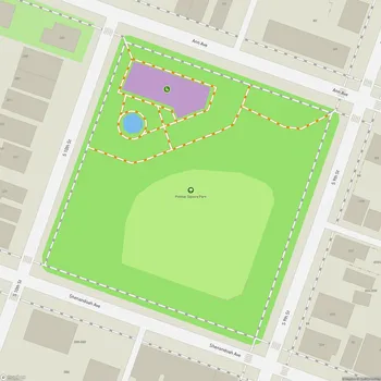
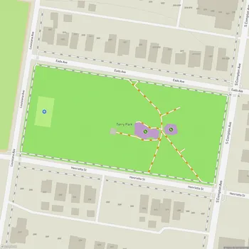
Interactive Park Map
About Bellerive Park
Historic Origins
Set in the Carondelet neighborhood of St. Louis, Missouri, Bellerive Park offers a peaceful escape with a rich backstory. Once called Riverside Park, it was renamed to honor the early French governor of Saint Louis.
Established in 1908, this compact 8.67-acre green space may be small in size, but it has plenty of character.
Riverside Views
Perched along the Mississippi River, Bellerive Park rewards you with breathtaking views of the mighty waterway as it flows southward. There's something mesmerizing about watching barges slowly navigate the currents from the park's elevated position.
Planning an event? Make a reservation at this park
The designers really made the most of this cliff-like setting, with benches thoughtfully positioned to face the river. Whether you're there for a sunrise or an evening sunset, the panoramic river vistas are quite impressive.
Layout and Accessibility
The park features a graceful crescent drive that you can access from Broadway, leading you up to the pavilion before connecting to a bridge that crosses over Broadway. This intuitive layout makes exploring the grounds a breeze.
You can easily navigate between the upper and lower sections of the park. A pleasant walkway through the hillside prairie connects to the lower sidewalk along Broadway, and if you're up for more river views, you can stroll over to nearby Sister Marie Charles Park.
Natural Features
Nature lovers will appreciate the park's pollinator garden that provides a haven for bees and Monarch butterflies - a small but mighty contribution to local biodiversity. The hillside prairie adds another layer of natural beauty and ecological value.
Been to this park? Share a or a
Taking center stage in the natural landscape is one of Missouri's largest Hackberry trees, offering generous shade on warm days. The thoughtful landscaping creates a refreshing pocket of nature within the urban environment.
Recreational Opportunities
If you're visiting with kids, the park includes a playground with slides and safety-conscious rubber flooring. The play equipment isn't enormous, but it's well-kept and meant for a quick energy burn.
Summer evenings take on a special charm when the park hosts bluegrass concerts every Monday night for about a month. It's the kind of authentic local experience that makes community parks special. Nature enthusiasts might want to mark their calendars for the monthly Audubon bird walks held on first Saturdays - a wonderful chance to connect with fellow bird watchers.
Visitor Experience
There's a reason locals describe this park as a tranquil retreat. It's the kind of place where you can sit quietly, gather your thoughts, and momentarily forget you're in a major city. The combination of flowing water views and open sky creates a calming atmosphere that's good for the soul.
You can visit daily between 6AM and 10PM, making it accessible whether you're an early riser or prefer evening outings. Dog owners are welcome to bring their furry friends, just remember to keep them leashed.
All Features & Facilities
Nature & Wildlife
Water Features & Activities
Visitor Services
Food & Gathering
Photo Gallery
Leave a Comment
ParkMagnet Score
Basic Park