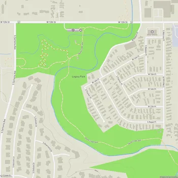
Good Earth State Park
Interactive Park Map
About Good Earth State Park
Location and Geography
Nestled southeast of Sioux Falls, South Dakota, Good Earth State Park spreads across 615 acres of natural beauty. The park straddles the South Dakota-Iowa border, with the Big Sioux River flowing through its heart.
Walk through this peaceful retreat and you'll experience a bit of everything - open prairie grasses swaying in the breeze, patches of light forest offering welcome shade, and a varied terrain of hills and gentle slopes. It's a glimpse of serene wilderness surprisingly close to Sioux Falls.
Rich Native American Heritage
Step into Good Earth State Park and you're walking on ground that was once a thriving hub for Native American trading and ceremonies. From 1300 to 1700 AD, this site was essentially a crossroads of Indigenous civilization, primarily home to the Oneota Indigenous Peoples, including the Omaha, Ioway, Oto, and Ponca tribes.
Planning an event? Make a reservation at this park
This is considered the most significant Oneota cultural site in the Midwest - recognized nationally when it received National Historic Landmark status in 1970.
Trails and Recreation
The park's network of hiking trails winds through its diverse landscape, offering everything from scenic overlooks to quiet moments of wildlife observation. These paths are thoughtfully designed and clearly marked, making them accessible whether you're an experienced hiker or out with the whole family - even younger kids can handle many of the routes.
One thoughtful touch: you'll find plenty of benches and rest areas strategically placed along the way, excellent for catching your breath while taking in the views. And unlike some parks that become inaccessible in certain seasons, these trails are maintained year-round.
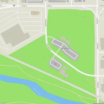
Visitor Center
At the park's core stands an impressive 11,000 square foot visitor center. More than just a building, it's a gateway to understanding the area's significance through various exhibits and programming focused on the Blood Run site's cultural and historical importance.
Been to this park? Share a or a
Before hitting the trails, take some time to explore the detailed historical displays and catch the informative 20-minute film. You'll appreciate the park's natural beauty even more once you understand its rich backstory.
Amenities and Facilities
No need to worry about basic comforts - clean restroom facilities can be found both in the visitor center and at various points along the trails.
Feeling hungry after exploring? Scattered across the grounds are picnic areas where you can enjoy a meal surrounded by nature's calm. For families with energetic little ones, the park features an outdoor natural playscape where kids can burn off some energy.
Recreation and Activities
While hiking might be the main draw, Good Earth offers much more. The diverse ecosystems make it an ideal spot for nature observation, birdwatching, and spotting local wildlife.
Many locals use the trails for daily exercise - the varied terrain provides natural intervals for walkers and runners alike. And if you happen to visit on a clear night, don't miss the opportunity for some spectacular stargazing away from city lights.
Pet Policy
Your four-legged friends are welcome to join the adventure, but they'll need to stay leashed throughout your visit. The park thoughtfully provides poop bags at trailheads, with garbage cans conveniently located in the parking lot.
Seasonal Information
Good Earth State Park welcomes visitors year-round, operating from 6 a.m. to 11 p.m. daily.
Just know that during the colder months (October 1 through April 30), some facilities like showers, flush toilets, and water systems may be closed due to seasonal conditions. The park entrance fee is $15 per vehicle.
All Features & Facilities
Nature & Wildlife
Water Features & Activities
Visitor Services
Food & Gathering
Photo Gallery
Leave a Comment
ParkMagnet Score
Top Park