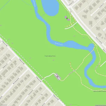
Duck Creek Greenbelt
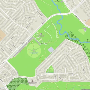
Interactive Park Map
About Duck Creek Greenbelt
Trail System
Nestled across 231 acres (with 14.5 developed), Duck Creek Greenbelt offers a refreshing natural retreat from the concrete jungle. Following its namesake waterway between Richardson and Garland in northeastern Dallas, this green oasis feels worlds away from suburban life.
The greenbelt features northeastern Dallas County's longest continuous trail - a 7.2-mile paved path that welcomes everyone from joggers to cyclists. With various loop options and generous width (8-12 feet), there's plenty of room for all types of trail users.
Scenic Features
As you meander along both sides of Duck Creek, you'll be treated to peaceful water views and chances to spot local wildlife going about their day. The natural setting creates a fantastic backdrop for reconnecting with nature.
Planning an event? Make a reservation at this park
The undeveloped portions of the greenbelt serve as a sanctuary for native plants and animals, adding to the area's ecological richness. It's a thoughtful balance - preserving the natural floodplain while giving us humans a place to play and unwind.
Trail Experience
The smooth, paved trail makes for an enjoyable walking or running session, ideal for your daily exercise routine. Just a heads-up: some stretches have minimal tree coverage, so you might want to avoid midday summer walks unless you're a fan of working up a serious sweat.
Note that signage can be a bit sparse in places. If it's your first visit, consider bringing your phone for navigation or taking a few minutes to get familiar with the route beforehand.
Connectivity
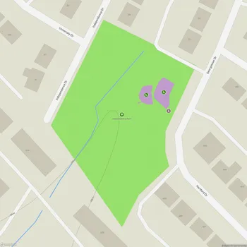
One of the coolest aspects of Duck Creek Greenbelt is how it links several other parks, including Troth Ablon Park, Gatewood Park, and Cody Park. This network of connections makes it easy to extend your outdoor adventure.
Been to this park? Share a or a
The southern end ties into the Mesquite Heritage Trail, while the northern section connects with Richardson's Owens Trail - essentially creating a super-trail for the ambitious explorer.
Amenities
You'll find clean, well-maintained restrooms here - a simple but appreciated feature that stands out compared to some other local parks. There are also designated picnic areas throughout, including a reservable space that works perfectly for birthday parties and family get-togethers.
Playground
Parents and caregivers will breathe easier thanks to the fully gated playground that keeps little adventurers safely contained while they play. This design feature provides peace of mind when watching over energetic toddlers and young children.
Pet-Friendly Features
Dog owners, rejoice! The greenbelt offers a fantastic setting for walking your four-legged friends, with plenty of interesting sights and smells to keep them engaged. The extensive trail system gives both you and your leashed companion a great opportunity to stretch your legs and get some fresh air.
All Features & Facilities
Nature & Wildlife
Water Features & Activities
Visitor Services
Food & Gathering
Photo Gallery
Leave a Comment
ParkMagnet Score
Great Park