Floodwall Park
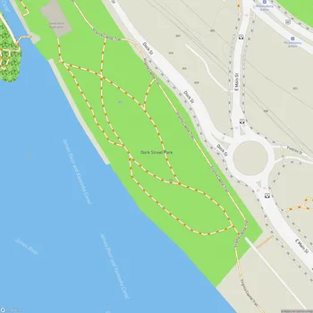
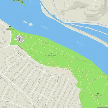
Interactive Park Map
About Floodwall Park
Flood Protection System
Completed in 1995, this park isn't just a pretty face - it's actually a crucial part of Richmond's defense against the sometimes temperamental James River. When heavy rains come, this clever system keeps the lower-lying areas of the city from turning into an impromptu swimming pool.
The floodwall itself is pretty impressive when you see it up close. On the northside, it towers between 15 and 25 feet high, while the southside section reaches a whopping 43 feet from top to river's edge. It's engineering with a purpose, but with views to match.
Park Layout
Stretching along the southern bank of the James River, the park's northside section extends 4,277 feet and shields 150 acres of Shockoe Valley, while the southside section spans an impressive 13,046 feet, protecting 600 acres.
Planning an event? Make a reservation at this park
The roughly 2-mile path offers some truly gorgeous views of Richmond's skyline and the James River. It's a serene location where you can escape the city hustle without actually leaving the city.
Recreational Activities
The narrow trail atop the floodwall has become something of a local favorite. You'll discover runners getting in their cardio, walkers enjoying a leisurely stroll, and hikers soaking in those panoramic views of the city and river below.
If you enjoy bird watching, you might spot eagles, ospreys, and cormorants, especially during the shad run. It's a peaceful spot to reconnect with nature while still being in the heart of Richmond.
Been to this park? Share a or a
Fishing enthusiasts also frequent the river's edge, but fair warning - you might lose a lure or two to underwater snags. Consider it a small offering to the James.
Amenities and Access
Getting to the floodwall trail is straightforward with two free parking lots offering a 3-hour limit. The path itself is mostly flat, with just a few stairs depending on your entry point - nothing too challenging for most visitors.
Your four-legged friends are welcome too, as long as they're leashed. Just be prepared to carry any waste for a while, as trash cans are somewhat limited within the park.
Connections to City Attractions
The park connects to other Richmond highlights. You can link your floodwall journey to the Richmond Slave Trail, the Canal Walk, and the Belle Isle Pedestrian Bridge - essentially creating your own custom Richmond tour route.
The park also provides access to the T. Tyler Potterfield Memorial Bridge and the RVA climbing wall if you're looking to add some variety to your outdoor adventures.
Historical Significance
Beyond being a place to stretch your legs, the park reminds visitors of Richmond's long relationship with the James River - both the benefits and challenges it brings to the city.
The entire floodwall system gets tested annually and includes a series of gates and portals that can be closed when the river decides to rise above its banks. It's fascinating to see infrastructure and recreation so thoughtfully combined.
Visitor Tips
This is a good spot for clearing your head when you need some quiet time. The path can get pretty windy and chilly during winter months, but it remains walkable year-round for those willing to bundle up.
If you're planning a longer exploration, bring plenty of water with you. And plan your bathroom breaks ahead of time - there are no restroom facilities in the park itself.
All Features & Facilities
Nature & Wildlife
Water Features & Activities
Visitor Services
Photo Gallery
Leave a Comment
ParkMagnet Score
Great Park