Leona Heights Park
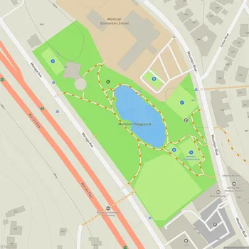
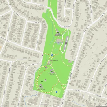
Interactive Park Map
About Leona Heights Park
Natural Features
Found in Oakland, this 65-acre city-owned park offers a refreshing break from the hustle and bustle of urban life. The steep, wooded canyon creates an immersive natural experience, with stunning panoramic views of the San Francisco Bay Area waiting to reward your efforts.
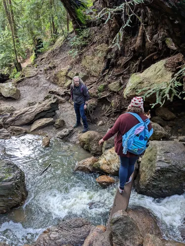
The heart of the park is the York Trail, meandering alongside the gentle Horseshoe Creek. As you wander through, you'll notice the landscape transform around you - starting in a cool, shady second-growth redwood grove near the lower entrance before transitioning into oak woodlands as you climb higher.
Planning an event? Make a reservation at this park
The year-round creek adds a soothing soundtrack to your adventure with its small waterfalls and represents a vital habitat for local wildlife. The sound of flowing water creates a peaceful atmosphere as you hike through the area.
Rich History
Step back in time as you explore Leona Heights Park, once home to bustling sulfur mines in the early 1900s. Keep your eyes peeled for fascinating remnants of this industrial era, including old mine tunnels and adits scattered throughout the landscape.
The area's history extends much further back, as Ohlone tribes once mined ochre here - a natural pigment they valued highly for ceremonies and everyday use.
Been to this park? Share a or a
You might also spot century-old mining ruins that have been transformed into impromptu canvases by local artists, creating an unexpected blend of history and contemporary expression that makes this park uniquely Oakland.

Scenic Views
If you're willing to tackle the climb to the upper portions of the park, you'll be richly rewarded with breathtaking vistas overlooking Oakland and the broader Bay Area. These viewpoints are especially beautiful during sunrise and sunset, when the urban landscape below is bathed in golden light.
On clear days, the sweeping panoramas provide a rewarding view after the challenging ascent - a good opportunity to rest and enjoy the scenery.
For those with extra energy to burn, the park connects to the neighboring Leona Canyon Regional Open Space Preserve, offering even more trails to explore and discover.
Trail Information
The York Trail is somewhat lesser-known among Oakland's hiking options. In a relatively short distance, you'll experience a diverse journey through various ecosystems.
Be prepared for a narrow path with some challenging sections. Parts of the trail do suffer from erosion, so you'll want to watch your footing, especially after rain has fallen.
You'll encounter some steeper sections equipped with paved stairs to help with the incline. The varied terrain provides a good workout, with most hikers completing the trail in about 1.5 hours.
Natural Environment
The park contains a variety of natural settings within its boundaries. Cool, shady redwood groves give way to sunnier oak woodlands as you climb, showcasing remarkable plant diversity within a relatively small area.
You're actually walking on ancient geological history - the park sits on what was once the Leona volcanoes, an extinct underwater volcano formation that adds another fascinating layer to your hike.
Small waterfalls scattered throughout the landscape add visual interest to your hike.
Visitor Information
While this park is a treasure for nature lovers and hikers, you should know the trails can be challenging. The terrain tends toward steep and rocky, so proper footwear is essential, and extra caution is needed during wet weather.
You're welcome to bring your four-legged friends, but keep them leashed on these narrow trails. Parking can be limited and somewhat confusing for first-time visitors, so you might want to plan accordingly.
Note that there are no restroom facilities within the park itself. Your best bet for facilities would be the recreation center (if it's open) or nearby businesses like the Safeway on Redwood Road.
The somewhat wild, minimally maintained character of the park is part of its charm, but it also means you should be prepared for potentially overgrown paths and fallen trees. This trail isn't ideal for young children, those with mobility challenges, or hikers uncomfortable with narrow paths alongside steep drops.
All Features & Facilities
Nature & Wildlife
Water Features & Activities
Photo Gallery (click to enlarge)
Leave a Comment
ParkMagnet Score
Decent Park