Middle Harbor Shoreline Park
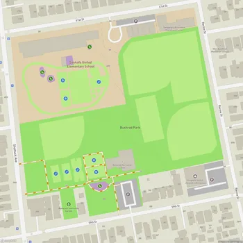
Interactive Park Map
About Middle Harbor Shoreline Park
Park Overview
Situated on the Oakland waterfront alongside the bustling Port of Oakland, Middle Harbor Shoreline Park spans 38 acres of urban oasis. This peaceful retreat was once the Oakland Naval Supply Depot until its closure in 1998, before the Port of Oakland transformed it into the public space we enjoy today, opening in 2004.
Despite being surrounded by the hum and activity of industrial port operations, there's something refreshingly serene about this park. Even better? It rarely feels crowded, giving you that rare Bay Area experience - beautiful views without the masses.
Scenic Views and Trails
Get ready for some seriously Instagram-worthy vistas of the San Francisco Bay, the iconic San Francisco skyline, and the majestic Bay Bridge stretching across the water. Nearly three miles of paved trails wind through the park, ideal for a leisurely stroll, morning jog, or casual bike ride. A section of these trails connects to the larger San Francisco Bay Trail network.
Planning an event? Make a reservation at this park
The paths meander alongside restored beach areas and a charming man-made lagoon created during the park's development. With flat, paved walkways throughout, the park welcomes visitors of all mobility levels.
Observation Points
The Chappell R. Hayes Memorial Observation Tower offers excellent 360-degree panoramic views of the bay and port operations, and is worth the walk from the parking area. Free viewing binoculars are available here and at other vantage points, letting you zoom in on marine traffic and the choreographed dance of the port's daily activities.
The park also features an amphitheater overlooking the bay, occasionally hosting live performances against the backdrop of shimmering waters.
Historical and Educational Value
Middle Harbor Shoreline Park also functions as an educational site. Interpretive signs throughout tell the story of this land, from its use by Native Americans to its naval base era.
Been to this park? Share a or a
Birdwatching enthusiasts will appreciate the variety of shorebirds that call the restored beach areas and lagoon home. In spring, you might spot herons, storks, geese, and mallards with their fuzzy offspring paddling along. Keep an eye out for ground squirrels bouncing across the fields too.
A nod to the area's military history stands in the form of the mast from the USS Oakland, honoring those who served during World War II.
Maritime Experience
One of the park's most unique aspects is its front-row seat to maritime operations. Where else can you watch massive container ships being loaded and unloaded by towering cranes at the adjacent Hanjin Terminal?
The juxtaposition of industrial machinery against natural elements creates a fascinating urban shoreline experience unlike any other in the Bay Area. And yes, those giant port cranes really do resemble the AT-AT walkers from Star Wars - you won't be the first to make that observation!
Amenities
The park offers several amenities. There are multiple clean restrooms with changing tables, plenty of picnic areas with tables and BBQ grills, and some covered spaces when you need a break from the sun.
Kids can burn off energy at the small playground with climbing structures near the pier at the far end of the park. There's even a small sandy beach area, but you should know there are no lifeguards on duty.
Parking is plentiful around the park, and security personnel in white trucks make regular rounds during operating hours. Note that your four-legged friends will need to sit this one out - dogs aren't permitted within park boundaries.
Recreation Opportunities
Beyond the obvious walking and sightseeing, try your luck fishing along the shoreline and pier. The open grassy areas provide perfect spots for impromptu sports games, morning yoga, or family picnics.
One notable feature is the park's relative tranquility. Even on weekends and holidays, it rarely gets crowded, offering a peaceful place to enjoy the spectacular views. If you can time your visit for sunset, you're in for a special treat as the San Francisco skyline transforms into a glittering silhouette against the painted sky.
All Features & Facilities
Active Recreation
Nature & Wildlife
Water Features & Activities
Visitor Services
Food & Gathering
Photo Gallery
Leave a Comment
ParkMagnet Score
Great Park