Brownie Lake Park
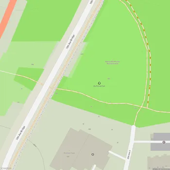
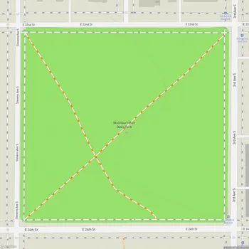
Interactive Park Map
About Brownie Lake Park
A Natural Oasis
Positioned in Minneapolis's Bryn-Mawr neighborhood, Brownie Lake Park spreads across nearly 28 acres of urban wilderness. As part of the Minneapolis Chain of Lakes Regional Park system, it's a breath of fresh air in the city landscape.
At the heart of the park sits Brownie Lake itself - the smallest and northernmost lake in the Minneapolis chain. But don't let its size fool you - this lake has a fascinating scientific quirk. It's a meromictic lake, which means its waters form two distinct layers that don't mix during spring and fall like most northern lakes do. Pretty cool, right?
Scenic Landscape
Steep, wooded slopes embrace the lake, creating a little pocket of serenity that feels miles away from city life. There's something refreshingly secluded about this place compared to other parks in the area.
Planning an event? Make a reservation at this park
If you're looking to escape the crowds at nearby Cedar Lake, you've found your spot. Brownie Lake has that hidden green quality that makes it well-suited for quiet moments - grab a book, find a peaceful corner, and just be.
Recreational Activities
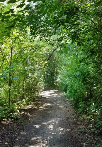
A simple dirt path loops around the lake, offering a gentle walk through nature that won't eat up your whole day. The trail is welcoming to hikers of all abilities, making it an accessible escape when you need a quick nature fix.
For those seeking more of an adrenaline rush, the western slope features a 1.4-mile single track mountain biking trail. Built in 2016, it holds the distinction of being Minneapolis's first "Black Diamond" trail - a testament to its challenging character. The trail connects with other biking routes, providing additional riding options if you want to explore further.
Water Activities
The lake offers a peaceful paddling experience, free from the buzz of motors (they're not allowed here). On the north side, you'll come across a canoe launch and storage rack that makes getting your kayak or canoe into the water a breeze.
Been to this park? Share a or a
A nice feature of Brownie Lake is its connectivity - you can paddle from here to Cedar Lake and Bde Mka Ska, creating a journey through multiple lakes.
If fishing is your thing, you'll appreciate the relative calm here. The lake hosts various fish species, and you won't have to compete for space with the crowds that gather at the chain's more popular fishing spots.
Beach Area
The park's modest beach area offers a quiet alternative to Minneapolis's busier shorelines. It's just the right size for spreading out a towel, diving into a good book, or simply watching the water while your thoughts wander.
Winter Recreation
When snow blankets the landscape, Brownie Lake transforms. The Chain of Lakes Ski Trail crosses the frozen lake and climbs its western edge, creating a gateway to the broader Theodore Wirth Park trail system.
These winter trails don't maintain themselves - they're kept in great condition thanks to a partnership between the Minneapolis Park and Recreation Board and the Loppet Foundation.
Connectivity
A path crossing over train tracks links Brownie Lake to Cedar Lake, inviting you to extend your outdoor experience. This connectivity is what makes the Minneapolis Chain of Lakes so special - one natural space flows into another, creating endless possibilities for exploration.
All Features & Facilities
Nature & Wildlife
Water Features & Activities
Food & Gathering
Photo Gallery (click to enlarge)
Leave a Comment
ParkMagnet Score
Good Park
Park Size
Opening Hours
Plan Your Visit
Weather
Top Restaurants Near Brownie Lake Park
Bryn Mawr Pizza & Deli
0.7 miles404 Cedar Lake Rd S, Minneapolis, MN 55405
Family-owned pizzeria serving authentic Italian-style pizza, hearty hoagies, and comfort food in a welcoming neighborhood setting.