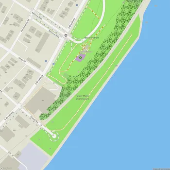
Fremont Park
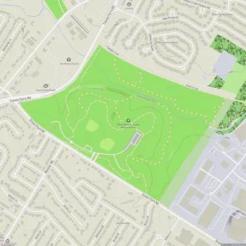
Interactive Park Map
About Fremont Park
History and Location
Located in the Benton Park neighborhood, Fremont Park has been a local green space since 1963. Covering a modest 2.31 acres, it was originally called Pontiac Central Park before being renamed to honor John C. Frémont, the American explorer, military officer, and politician who left his mark on history.
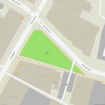
You can find this little urban oasis in the northern section of Benton Park, with Lynch Street forming its northern boundary, Salena Street to the east, and the alley behind McNair Street to the west. Wisconsin Street simply dead-ends into the park's southern edge, almost as if it's delivering you right to this community space.
Park Features
The heart of Fremont Park is its generous open area, well-suited for impromptu games or just lounging about. There's a playground that the little ones will appreciate, but be mindful that some spots might need attention due to persistent tree roots making the ground a bit uneven in places. Despite this, the play area remains clean and spacious enough for kids to burn off energy.
Planning an event? Make a reservation at this park
One of the park's natural highlights is its collection of mature oak trees that create perfect shade pockets, especially between the playground and the eastern field. These leafy giants add character and much-needed cooling during those sweltering St. Louis summers.
Dog owners will appreciate the fenced dog area complete with a secure gate code system. This area allows your four-legged friends to socialize and stretch their legs safely while you chat with fellow pet parents.
Amenities
You won't have to cut your visit short due to basic needs - the park provides drinking water and portable restrooms for both men and women. Nothing fancy, but certainly functional and convenient.
Been to this park? Share a or a
The park's layout, with its generous open spaces, makes it an ideal spot for small neighborhood gatherings or family celebrations. There's plenty of room to spread out blankets or set up lawn chairs.
Surrounding Area
Right next to the park stands a piece of local history - the former Fremont Elementary School built in 1896. This beautiful old building has found new life as the St. Agnes Senior Apartments, bringing generations of community members into the park's orbit.
This proximity has led to a sweet community feature: gardens tended by the senior residents on the side opposite the open field. These patches of cultivated green add color and reflect the intergenerational nature of this neighborhood hub.
Recent Improvements
2016 and 2017 brought welcome updates after the community had their say in the planning process. The park now sports a full-court asphalt basketball court where local players can show off their skills, a memorial bench for reflection, refreshed playground equipment for the youngsters, and a splash pad themed after the Marquette Dragons - fantastic for those hot summer days when kids need to cool down.
Community Use
Fremont Park has evolved into a true neighborhood living room, especially popular by families with young children. The combination of playgrounds for kids and the dog park attracts various visitors throughout the day from around the neighborhood.
All Features & Facilities
Active Recreation
Nature & Wildlife
Water Features & Activities
Visitor Services
Food & Gathering
Photo Gallery
Leave a Comment
ParkMagnet Score
Decent Park
Park Size
Opening Hours
Plan Your Visit
Weather
Top Restaurants Near Fremont Park
Arzolas Fajitas + Margaritas
115 feet2730 McNair Ave, St. Louis, MO 63118
A vibrant Tex-Mex spot serving sizzling fajitas and expertly crafted margaritas in a cozy atmosphere.
Sidney Street Cafe
702 feet2000 Sidney St, St. Louis, MO 63104
Sophisticated New American restaurant featuring inventive cuisine in a warm, upscale atmosphere with exposed brick.
Frazer's Restaurant & Lounge
823 feet1811 Pestalozzi St, St. Louis, MO 63118
Fine dining establishment featuring globally inspired cuisine, craft cocktails, and eclectic decor in a cozy atmosphere.
Top Hotels Near Fremont Park
Lemp Mansion
0.5 miles3322 Demenil Pl, St. Louis, MO 63118
Historic mansion turned atmospheric inn offering unique dining experiences and ghost tours in distinctive Victorian surroundings.