Clatsop Butte Park
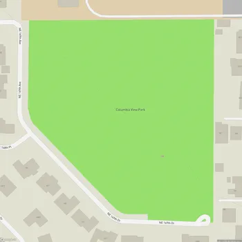
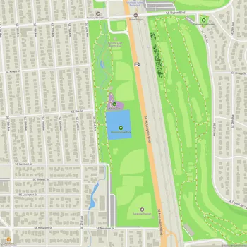
Interactive Park Map
About Clatsop Butte Park
Breathtaking Views
Perched atop Clatsop Butte just south of Powell Butte, this 44.41-acre (17.97-hectare) gem is a hidden lookout point that rewards visitors with spectacular panoramas. On clear days, you can take in sweeping views of downtown Portland, the majestic Mount Hood, and even catch glimpses of Mount Adams and Mount St. Helens in the distance.
The park has thoughtfully positioned two benches along the trail where you can sit and soak in these impressive vistas. There's something incredibly calming about this spot - away from the city's hustle and bustle, it's a great place to clear your mind while gazing at nature's grandeur.
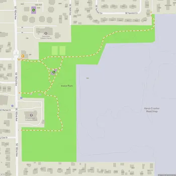
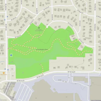
Peaceful Trails
A 0.6-mile wood chip trail winds along the butte's summit, offering an easy route for exploration. Made with ADA engineered wood chips, the 8-foot wide path provides accessibility for most visitors.
Planning an event? Make a reservation at this park
Whether you're in the mood for a contemplative stroll or a refreshing jog, the trail provides a peaceful experience. Many locals bring their four-legged friends (on leash, of course) to enjoy the peaceful surroundings together.
Wildlife Haven
The densely forested hillsides and creek frontage create a sanctuary for local wildlife. Keep your eyes peeled and you might spot deer quietly grazing, or perhaps a fox or coyote moving through the underbrush. Bird enthusiasts will appreciate the northern flickers, pileated woodpeckers, and various other feathered residents that call this park home.
If you visit during summer, you can find wild blackberry bushes scattered around the park. You might enjoy picking a ripe blackberry while out on a walk if you visit during the right season.
Community Connection
Clatsop Butte Park also serves an important function in the community's emergency planning. It's designated as a Basic Earthquake Emergency Communication Node (BEECN), as a gathering point where people can seek assistance or report serious damage after a major earthquake disrupts normal communication channels.
Been to this park? Share a or a
The park has grown gradually since 2000, when the City of Portland purchased the initial 16 acres. Through additional acquisitions and with input from the Pleasant Valley Neighborhood Association, it has evolved into the serene retreat it is today.
Situated in a lovely residential area, Clatsop Butte Park offers both nearby residents and visitors a tranquil escape - a place to reconnect with nature without venturing far from the city.
All Features & Facilities
Nature & Wildlife
Photo Gallery
Leave a Comment
ParkMagnet Score
Decent Park