Saint Mark's Greenbelt
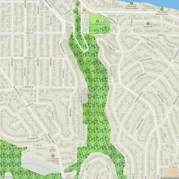
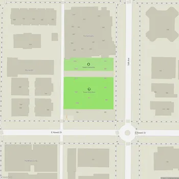
Interactive Park Map
About Saint Mark's Greenbelt
A Natural Urban Retreat
Tucked between Capitol Hill and the rumble of Interstate 5, Saint Mark's Greenbelt acts as Seattle's green buffer zone. This urban wilderness stretches along East Blaine Street to the west and 10th Avenue East to the east, with its edges gently blending into the surrounding neighborhoods.
What makes this space special is how it shields nearby homes from the constant hum of highway traffic, creating a pocket of tranquility in the bustling city.
Wild City Living
Despite its urban setting, the greenbelt has become a surprising haven for wildlife. Dense vegetation creates homes for city critters, while a network of winding trails invites you to explore. In the western section, a small creek meanders through the landscape, sometimes disappearing into underground pipes before reemerging elsewhere.
Planning an event? Make a reservation at this park
It's one of those rare places where you can take a deep breath, forget you're in the middle of Seattle, and just enjoy a moment of calm on a leisurely stroll.
A Green Legacy
The story of this green space took an important turn in 1993 when Seattle added it to properties protected under the city's green space policy. The greenbelt grew even larger later in the decade when the Streissguth family generously donated additional land, including a permanent garden that enhances the area's natural beauty.
Like many urban natural areas, the greenbelt faces ongoing challenges with invasive species. Holly and ivy have proven particularly aggressive, overtaking sections of the landscape in recent years.
Finding Your Way In
If you're looking to explore this hidden retreat, head to St. Mark's Cathedral on 10th Avenue East. From the cathedral's parking lot, you'll find trailheads in the south and southwest sections that lead to a steep but rewarding path through the southern portion of the greenbelt.
All Features & Facilities
Nature & Wildlife
Water Features & Activities
Visitor Services
Photo Gallery
Leave a Comment
ParkMagnet Score
Decent Park
Park Size
Opening Hours
Plan Your Visit
Weather
Top Restaurants Near Saint Mark's Greenbelt
Cook Weaver
0.4 miles806 E Roy St, Seattle, WA 98102
Upscale New American restaurant serving creative Eurasian dishes with craft cocktails in a cozy, artistically decorated space.
Aoki Sushi & Grill
0.4 miles621 Broadway E, Seattle, WA 98102
Casual Japanese restaurant serving fresh nigiri, sashimi, and creative sushi rolls in a friendly neighborhood setting.
Altura
0.4 miles617 Broadway E, Seattle, WA 98102
Upscale Italian restaurant featuring handmade pastas and seasonal dishes in an intimate dining setting.