Wolf Creek Ravine Natural Area
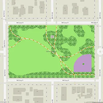
Interactive Park Map
About Wolf Creek Ravine Natural Area
Tucked Away on Queen Anne's North Side
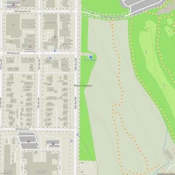
Wolf Creek Ravine Natural Area is one of those hidden green pockets that makes Seattle so special. Nestled on the north side of Queen Anne, this natural space features Wolf Creek flowing through a deep canyon that's crossed by the Queen Anne Drive bridge - a local landmark connecting Nob Hill Place North and 2nd Avenue North. If you're trying to follow the ravine's path, it roughly traces along 3rd Avenue North between Queen Anne Drive and Lynn Street.
A Breath of Fresh Air for Urban Wildlife
As part of Seattle's park system, this little ravine plays a surprisingly important role as an ecological corridor amidst all the concrete and buildings. It's like a wildlife highway through the city, helping maintain biodiversity where you might least expect it.
Planning an event? Make a reservation at this park
The steep, forested slopes offer a glimpse into what Seattle looked like before we built all over it. If you're into wildlife spotting, swing by at sunset to catch bats swooping through the air - a pretty magical sight in the middle of the city.
Nature's Quiet Surprise
What's cool about the ravine is how it creates these unexpected elevation changes that make you forget you're in the middle of urban Seattle. Depending on when you visit, you might catch wildflowers dotting the landscape, adding splashes of color to the green backdrop.
Nearby, you'll discover a community P-Patch garden where locals grow everything from dahlias to kale. It's another layer of green that complements the natural area and adds to the neighborhood's character.
A Piece of Seattle's Green History
The ravine has some interesting historical roots tied to Seattle's park development. Back in the early 1900s, the Olmsted Brothers - the rock stars of landscape architecture in their day - included a sixteen-acre site on the eastern side of the ravine in their master plan for Seattle's parks and boulevards.
Been to this park? Share a or a
This area later became Magnolia Park, showing how the city has long valued keeping these natural spaces intact, even as Seattle grew up around them.
All Features & Facilities
Nature & Wildlife
Water Features & Activities
Photo Gallery
Leave a Comment
Opening Hours
Plan Your Visit
Weather
Top Restaurants Near Wolf Creek Ravine Natural Area
Un Bien
0.3 miles319 W Galer St, Seattle, WA 98119
Caribbean restaurant specializing in flavorful sandwiches with perfectly seasoned meats and bold spices.
Hummingbird Sushi
0.3 miles11 Mercer St, Seattle, WA 98109
Modern sushi restaurant featuring creative omakase courses with innovative fusion flavors and exceptional presentation.
SAI Sushi & Sake
0.3 miles25 W Mercer St, Seattle, WA 98119
Intimate Japanese restaurant offering unique omakase experiences with rare fish and personalized service.